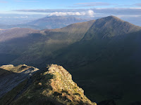
An 11km run with Steve M on his annual November visit (having spent the previous night in Lorton).
Route: leaving the car in the White Moss car park (£2 per hour) and crossing the road and then the river on a footbridge and along woodland paths climbing to reach the start of Loughrigg Terrace. Along this and then the higher track, at the end, through trees to reach the summit of Red Bank. Descending, left, to reach a track round the north of Loughrigg Tarn. Part way along taking a footpath on the left across fields to meet a stony walled track rising and turning to circumnavigate the hillside rising to reach a spur and following a grassy path, right, to reach Lily Tarn. Descending on a grassy, muddy path to reach the main track over Loughrigg and here turning left and uphill for 100m to find a path on the right descending to the Under Loughrigg road and along this towards Grasmere. Turning left, before the road re-crosses the river, onto a rising road then shady track to reach views of Rydal Water. Taking the lower lakeside path back to the initial woods and thus recrossing the footbridge and back to the start.
Conditions: cold but mainly high cloud.
Pub: the Badger Bar, Rydal, for Barngates Red Bull Terrier and Handsome Blonde.
25 November 2018
24 November 2018
Grisedale Pike and Hopegill Head from Whinlatter Pass
A solitary 2.5 hour, 10km walk while Lois was on a theology course.
Route: leaving the car in the free parking area to the south of the Whinlatter Pass just above the two cottages. Walking along the route of the C2C on a forest track to a point where a wide path heads right with a post (N78) and leading uphill, eventually reaching the edge of forest and then along a clear, well-established path on an increasingly distinct ridge up to Hobcarton End. Then along the broad ridge to Grisedale Pike. Descending and re-ascending to reach Hopegill Head and down the greasy and slightly worrying rocky ridge to Ladyside Pike. Down the broad grassy ridge and at the first fence heading right steeply down tussocky grass to the valley. Then left through two gates and along a forest track, spurning a left turn and then U-turning to climb gently for 1km and down to the start.
Conditions: cold and windy but clearing with some late sun.
Pub? much later, after picking up Steve M from a train at Penrith and Lois in Keswick, the Pheasant, Bassenthwaite for Cumbrian Legendary Ales Loweswater Gold.
18 November 2018
Wansfell Pike and Wansfell from Troutbeck
Route: Leaving the car parked just over the river at the bottom of Troutbeck (perhaps 50m up the road) and taking Robin Lane round to the south of the fell, keeping with the lower track round to High Skelghyll. On entering the wood, taking a path rising diagonally eventually to reach the observatory and the ridge to the summit. For the first time taking a path to the left and higher than the normal route, gaining the ridge sooner. Thence along the boggy ridge to Wansfell and then down the path to Nanny Lane and back to Troutbeck.
Conditions: a sunny day with an almost cloudless blue sky and ridiculously warm for late November.
Pub: the Watermill, Ings for Theakstons Old Peculier and Windermere Bad Dog IPA.
4 November 2018
Cockermouth stroll
Route: leaving the Aldi car park and climbing some steps to reach a gravel section of old railway. Following this south east as it became a snicket between houses and then ran beside a car park to cross the A5086 and rejoin a more obvious line of track, crossing a viaduct, passing underneath Lorton Road and heading out of town. At a natural terminus, turning right on a Sustrans route and then entering a cemetery pausing to watch red squirrels darting about in rude health. Then crossing Lorton Road to head through a housing estate and down onto a path beside the Cocker. South West on this across fields to a footbridge and then along the other side of the river, in a park, underneath the viaduct and regaining the track by steps, joining and crossing the A5086 and back along the initial outward track.
Conditions: high clouds and a thin blue sky to the north while the central Lake District was in cloud and rain.
Pub: much later on the drive home, Tweedies, Grasmere for Hawkshead ITI and Fell Golden Goldings and lunch.
Subscribe to:
Posts (Atom)