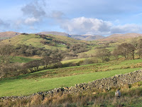
A nearly 8km run on a cold sunny morning.
Route: leaving the car on the road north of Levens at OS Grid Ref: SD 48908 87585 at a junction of paths (space for 5-6 cars) and running north west, gently uphill on grass, following occasional posts to reach the track to Helsington Church. Then continuing onto Scout Scar, staying to the left and, at the obvious geological fault, descending under the scar on a rather trippy path (in virtue of roots and stones, though obviously recently pruned back of brambles) to Barrowfield Farm. Heading south on the track, then right onto the footpath, and then back on the track under an impressive looking Burnbarrow Scar to cross the road to Brigsteer and proceeding on a bridleway past Wells Garth. There, turning sharp right and descending, with some complaints from the ranks, crossing a field to Parkend Farm. Crossing the road and descending further, diagonally, before turning left into the woods of Brigsteer Park. Flat along the valley bottom until, eventually, climbing laboriously, via a track to the left, back to the start.
Conditions: 2C, sunny and cold, frosty and muddy underfoot by turns.
Pub: the Hare and Hounds for half pints of Cumbrian Legendary Ales Loweswater Gold.
19 January 2020
18 January 2020
Craggy Wood 6km run
A short run so as not to over-stress sporting niggles.
Route: leaving the car in the Mill Yard and heading over the footbridge over the river and then the middle path to Staveley Back Road and up to the gate into Craggy Wood. Round to the right and up and swinging left at altitude, looking out for, but finding only one of, the survey posts mentioned in a recent Guardian article. Exiting the woods and tuning right up sodden fields, over the ridge and down to Littlewood Farm. Right along the road to the walled track along the edge of Mike’s wood and picking up a metalled track turning right to descend to Staveley Back Road turning right and then left back to Staveley across fields.
Conditions: blue sky, bright sun, cool but very wet (and deeply muddy and slippery) under foot.
Pub: the Hawskhead Brewery for Hawskhead WPA, NZPA and lunch.
5 January 2020
Whitbarrow Scar
A 7km run on the last day of the Christmas holidays.
Route: leaving the car in a lay-by opposite the Lyth Valley Inn and running uphill on a muddy snickleway, forking right and then along a track to reach the green road exiting Row. Turning right then left following a footpath sign but actually then following a track up the field, through a gate and then onto the top of the Scar bending left, past a cairn and over a stile. Here, following a more rocky path roughly parallel with a wall but bending right and climbing to a substantial well built summit cairn. Back-tracking to where a ridge of grike joins the wall and taking a stile to descend, bending left at a fork and then tracking north on sometimes very muddy paths before descending to Row and then back to the outward path.
Conditions: low cloud and drizzle.
Pub: the Lyth Valley Inn for Lakeland Gold.
3 January 2020
The environs of School Knott
A 10km run to the east of Windermere.
Route: leaving the car in the Booths car park (free for customers for 2 hours) and running through the shop and out onto the pavement of the A591 and then east to reach a footpath to the right. Crossing surprisingly marshy farmed fields and then over the railway line before heading left past garages and then left on a narrow road. At the end, turning left at a footpath signpost and then right through a gate marked 'no camping' into Schoolknott Plantation and across grass, rising slowly and selecting middle ways at subtle path junctions to exit onto open land and thence, at a walk, up to School Knott. Descending to a tarn behind and then cutting a corner to rejoin a previously taken path ascending to reach a high-point with a good tree and views back to the central fells. Descending to cross through Hagg End, turn right on a road and then the second left path to Crag House. Descending a shallow valley and re-ascending, climbing a gate to avoid local flooding. At a signpost, taking a novel left turn to Borwick Fold, across a road and then on another footpath through a small wood before joining an open road. Taking the second left turn onto a path back through Schoolknott Plantation and then back through the housing estate, right up Thwaites Lane under the railway line and back to the start.
Conditions: surprisingly wet under foot but a sunny day.
Pub: Pie and Pint/The Crafty Baa, Windermere, for Barngates Red Terrier and Oakham Citra.
Subscribe to:
Posts (Atom)