31 January 2025

Cunswick Scar

A 5km stroll with Bridget and Simon from their house on Queen’s Road.

Route: leaving 1 Mountain View, Queen’s Road via its back gate and walking between allotments to a lateral path and following this north before turning left uphill to reach the path coming from the Tramway. After a little while doglegging left right to rise up across the golf course above Kettlewell Crag, descending to cross the A591 on the footbridge and then following the obvious route to the summit cairn of Cunswick Scar. 

Descending slightly further west and then bending back to the outward path taking a tiny variant slightly further north when leaving the golf course.

Conditions: a still cool 3C day with high cloud.

Pub: the Eagle and Child, Staveley for Brathay Gold and lunch, joined by Paul Taylor on his way to an orienteering training weekend.

29 January 2025

Stroll from Buttermere taking in three tiny summits

A tiny 3.4km stroll, thus meeting the new 2025 minimum distance (3km) for an ‘Outdoor Day’.

Route: leaving the car in the NT car park (quite empty at 11:30am on a January Wednesday though in lovely sun) and taking the path north-west through a gate to turn left onto a clear gravel path. Almost immediately turning right off this on a fainter path to ascend slightly and then descend to the north of Long How and to the lakeshore. 

Turning left to cross a footbridge and ascend Nether How, descending to the path round it. Crossing another footbridge (over Mill Beck) to strike steeply pathlessly up Long How, first taking in the northern end, then the main summit, watching 5 deer first on the summit and then below for about 5 minutes. Then noticing two goats to the right on the gravel path below. Descending back to the outward path to cross the c-road and take the path opposite under High House Crag doubling back to reach its summit before heading east to reach the path above Mill Beck and thus to the pub.

Conditions: after some days of poor weather, a cloudless sunny day.

Pub: an empty Buttermere Court Hotel for Corby Summit and Corby Blonde.

28 January 2025

Variant circuit of Swinside

A10km run round Swinside. 

Route: leaving the car 50m west of the Orthodox Church in a parking area up a gravel track and running back - past the currently removed Buddhist bridge (the ‘Chicken Bridge’) - and through the village on footpaths, crossing the village centre road bridge and then taking a footpath on the right, between Coledale Beck and the campsite, to a footbridge over the beck and then following it along to Little Braithwaite. 

Taking the c-road to Ullock and, for the first time, the soggy flat path across fields to a private road in Portinscale. Turning right on this to the c-road and right again to find, on the left, the Cumbria Way uphill through Fawe Park. Following the Way to near the Hawes End Outdoor Centre and turning right on a tarmac drive to join the c-road to the (closed on Monday and Tuesday in January) Swinside Inn. Descending to the road to take the path on the right down to, and slightly along and across, the river to Uzzicar (the riverside path remaining closed since 2020). Running north along the road north for 200m to join a path rising - now at a walk - above a wood and then descending into Braithwaite and back to the car.

Conditions: dry with hints of sun.

Pub: the Royal Oak, Braithwaite, for Courage Directors.

25 January 2025

High Seat from Great Wood via Bleaberry Fell

A 12km walk - which proved entirely enough for T - on a cold day, the day after Storm Eowyn.

Route: leaving the car at the Great Wood car park (not full at noon on a January Saturday) and walking north on forest paths towards a transmitter. Turning right and ascending a path by the stream, crossing this to a road, and then back to climb steep fellside to the summit area of Walla Crag but today leaving its summit for another expedition. Continuing past the summit area and turning left on somewhat boggy ground to join a clear alluvial soil Fix the Fells path and following this uphill and then more steeply uphill to the summit cairn. Taking the opportunity of a good shelter cairn to put on more clothes against a biting cold wind and suddenly massing black clouds to the south, and scanning the horizon for likely rain.

Continuing on the path south towards High Seat, initially on partially frozen bog but, on the ascent, joining a clearly recently built alluvial soil path. On the summit, deciding against the initial plan to continue to High Tove (which wold have involved a lengthy and quite familiar return on the Watendlath-to-Ashness Bridge path) and heading, instead, directly down towards Ashness Bridge, along Ashness Gill and then Barrow Beck, soon finding a fine new flagged path across one patch of marsh. Briefly joining the c-road over the bridge and taking the lower level quasi-balcony path (with views over Derwent Water and very close sighting of two deer on the path immediately below) to reach Great Wood and thus the car park.

Conditions: dry with just two spits of rain but very a cold wind at altitude.

Pub: for the first time, the Mary Mount Hotel for a mysterious (brewery unknown) Surprise View Gold (3.8%) beer which was very pleasant.

19 January 2025

Craggy Wood fruitless aqueduct vent search

A 4km second attempt, five years after a previous one, to find the second of a pair of aqueduct vents mentioned in a 2019 Guardian article.

Route: leaving the car outside the Eagle and Child at 11:30am and crossing the playing field behind the primary school to reach the path past the Mill Yard, across the river, and gently uphill to cross the c-road and enter Craggy Wood (where a number of trees had fallen over since a previous visit and the top right corner of the wood had been very-recently fenced off, with several new gates in and out). 

Following the path round to reach the upper balcony path and, again finding no trace of a second vent up or down the path of the aqueduct. Exiting the wood and desending to Barley Bridge (the water crashing over the weir having been audible way up the hillside), then back along the road to join the river and return to the pub.

Conditions: 1C, low cloud and drizzle.

Pub: the Eagle and Child, Staveley, for Tirril Staveley IPA and Cumbrian Ales Pinnacle Pale Ale.

4 January 2025

Midwinter run to Isel and Sunderland from Blindcrake

A near 9km run on a winter day with both icy lanes and deep waterlogged mud to contend with. (Ticking off another Outlying Fell from Wainwright, Clints Crags, by chance.)

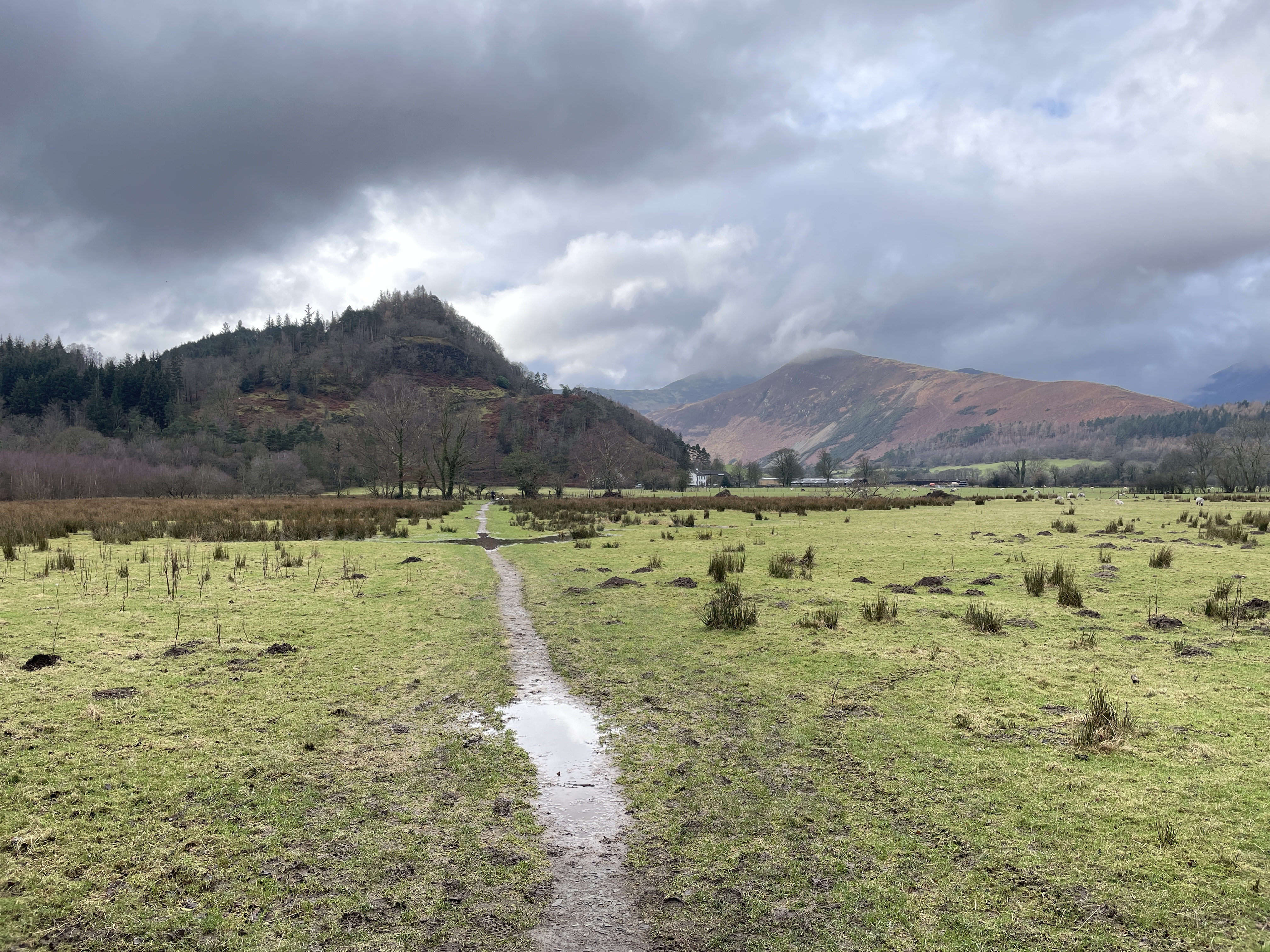
Route: leaving the car by the side of the road in Blindcrake (just before a triangle of roads) and picking a careful way on the verge beside a hazardous frozen lane downhill towards Isel. Luckily, almost immediately finding a very muddy permissive path, parallel with the road, through trees on the right, eventually forking left to rejoin the road where a marked right of way crossed. Continuing over a stream (tributary of the Derwent) and past both the very grand Isel Hall and a road junction signed left to Sunderland to a muddy track across fields on the left at a sharp bend right in the road. This leading to a very muddy quagmire junction of fields and after, much difficulty, crossing through broken gates and a bridge to edge onto a drier, more frozen field and then a frozen track. 

Halfway along this section, Lois pausing out of respect for/to an apparently dead sheep which, on her closer inspection, proved merely to be incapable of regaining her feet in the frozen conditions. (After some attention from Lois, the sheep was righted and skittered off eventually down the lane, returned to the possibility of a future life. In sum: Lois very obviously saved a sheep’s life which would otherwise have frozen to death!) Continuing, ourselves, across fields to gain (the verge of) a frozen c-road to Sunderland. Turning left on stony farm tracks, slowly gaining altitude on fields and choosing to take the higher route, passing the clear ruins of a cottage (Thackray Cottage, owned by the gamekeeper once but burned down) to near the summit of Clints Crags - a limestone outcrop, SSSI and SAC - with wide views south over Bassenthwaite (and remains of a small quarry to the north). Descending across sodden fields to gate, and on to a tree-lined, fenced and waterlogged track, to a road, there turning left back down into Blindcrake.

Conditions: mainly grey and cloudy and 2C. A mix of frozen lanes and very muddy quagmires.

Pub: the Swan, Inn, for Brakspear Oxford Gold and Gravity.
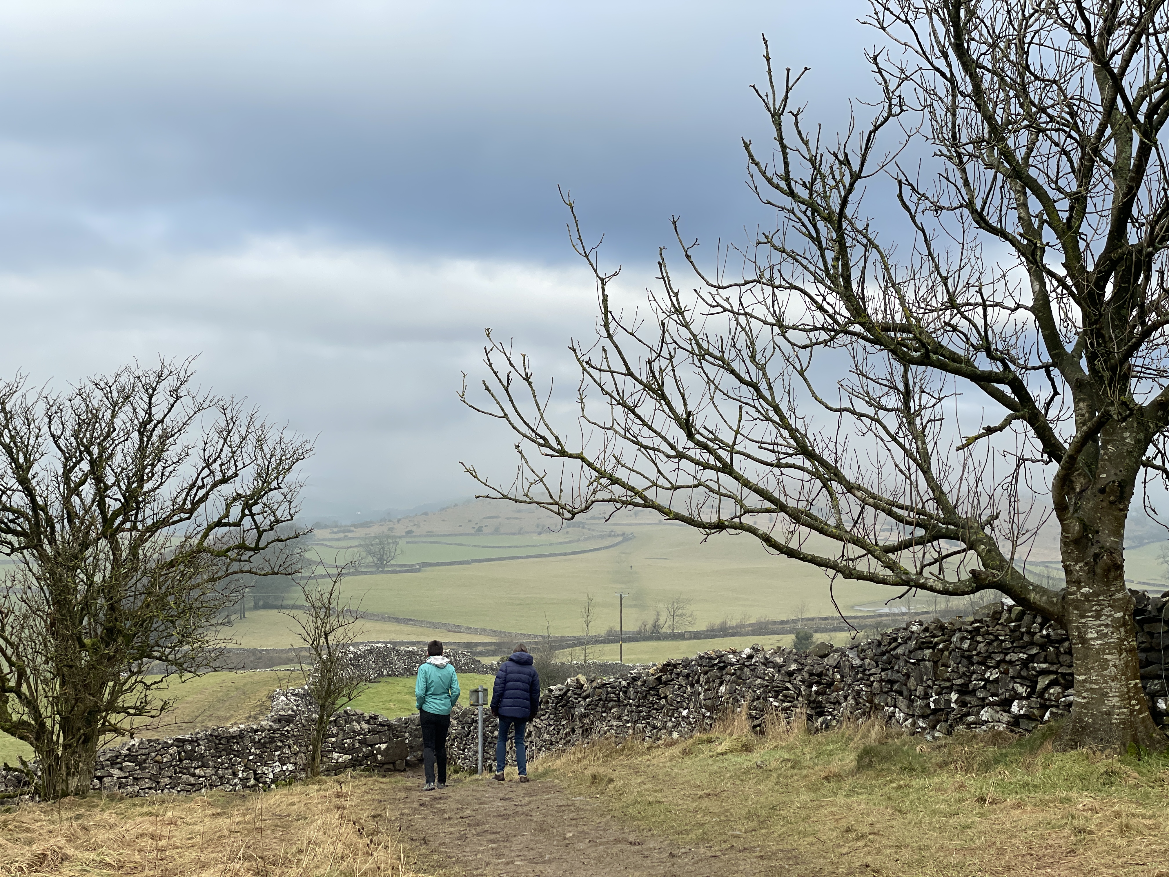
3 January 2025

Dalemain Round from Dacre taking in Dunmallard Hill

A 9km walk on a surprisingly sunny day (having woken to cloud in Lorton) before a pub lunch with Kate. (Taking in a Wainwright Outlying Fell, unsuspectingly: Dunmallet (Dunmallard Hill).)

Route: leaving the car outside the Horse and Farrier, Dacre, and walking downhill to turn left towards the castle, thus taking the lowest of three paths exiting the village. Joining a wide level track for about 2km along the edge of fields to Dalemain. Exiting through the car park (having admired a herd of deer sunning themselves just over the fence) onto the A592 and heading south for 100m to a stile to the right and then continuing across fields rising slowly to the flat summit of Flusco Hill. Descending to cross the A592 to take a muddy path past a private fishing pond and then along the River Eamont to the car park by the new bridge at Pooley Bridge. 

Failing to find a direct path up the hill marked on the map (which might have been unpleasant, anyway) taking a path backtracking anti-clockwise round Dunmallard Hill, past a junction and winding its way to the summit (no real views through the trees). Descending the same way to the junction and then crossing a field, bending left to cross the A592 again and across another muddy field rising to a c-road. Turning right then left at a T junction, along periodically icy roads, to reach Dacre.

Conditions: 2C but warm in the sun. A mixture of muddy and frozen ground under foot.

Pub: the Horse and Farrier, Dacre, for Eden River Fuggles Blonde, Kirkby Lonsdale Jingling Lane and lunch.

2 January 2025

14km circuit to the Kirkstile Inn

A spontaneously-extended icy walk to the Kirkstile Inn, and back, on a glorious cold and frosty day.

Route: Leaving the cottage comparatively late (11:45am) and walking up the Boonbeck Road and then right on the lateral footpath to a farm and driveway back left to Scales and then up the enclosed track to reach the balcony path to High Swinside, with some of the recent heavy rain locked up in frozen mud. Then south along the road to the footpath on the left along to the new footbridge under Dodd and then continuing along the valley-side path. Spurning a shorter route that would have secured provisions for an evening meal (ie before the LVS shut), continuing to the path to Beck House and Pickett Howe, which involved a tricky crossing of Coldgill beck in spate. Reaching the road near Palace Howe and picking a way across occasional patches of ice along roads to the Kirkstile Inn for beer and a light lunch.

Afterwards, taking the Thackthwaite Road, again with some icy patches, back to Lorton and across the fields via the church home.

Conditions: after a cold (-2C) night following heavy rain, a beautiful sunny frosty day but with a mixture of waterlogged and frozen conditions under foot.

Pub: The Kirkstile Inn for Pinnacle, Loweswater Goldn and Vanilla Oatmeal Stout (on keg) and lunch (a scotch egg and a salmon sandwich).