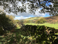
An arduous solitary run in poor conditions.
Route: leaving the Staveley Mill Yard via the foot bridge over the River Kent and taking the muddy path over south east field in the direction of the sewage works. Turning right along the road and then left 400 yards later on a steep drive before crossing a stream below a small waterfall at Side House and rising gently onto the edge of the fellside. Then turning left through Birk Field farm to join the minor road north and following this up the valley on road and track to Ghyll Bank, turning left descending over fields to turn right onto Hall Lane. Gradually gaining altitude again on a stony track diverting onto sodden fields where the bridge over Hall Beck had been removed. At this point the rain and wind rendered sight through spectacles impossible and so shuffling on across marshy paths peering over the spectacles. Taking a grassy path first rising and then descending, and becoming rough under foot and then a stream, through the HP Plantation. A tree having fallen across a gate, climbing a fence and through the fallen tree to regain the path. Back and faster along the road to Ullthwaite Bridge and then, insanely by flooded track and then a quiet road to recross the river at Scroggs Bridge. Along a path to join the start of Hall lane and then back to the footbridge into the Mill Yard.
Conditions: cloudy with wind and rain on higher ground. Sodden under foot.
Pub: the Hawkshead Brewery, Staveley joined by Lois for lunch and for Hawkshead WPA and NZPA.
22 October 2017
15 October 2017
King's How
A short walk on a dark but pleasant autumnal Sunday.
Route: Leaving the car at the NT car park for the Bowder Stone and following a sign to it down towards the road and then on a well-made path to the Stone. Proceeding on a quarry track down to the road and along it to a sign and stile on the left. Taking a faint waterlogged path trending upwards and eventually left to climb a faint ridge before heading slightly right to reach a vague saddle. After a 200m taking a path back left to gain the ridge to the summit of King’s How. Onwards, descending a muddy stony path which sometimes became obscured in bracken eventually joining a well-made pitched path slippery with slime and damp leaves and picking our way slowly down to reach the saddle at Brock Bield. Turning left to climb gently before descending towards the road but taking a left-hand path back to the start.
Conditions: dark and cloudy but unseasonably warm.
Pub: the Scafell Hotel, Rosthwaite for Jennings Sneck Lifter.
8 October 2017
Staveley 8km run
A short 7.5km run on a surprisingly sunny autumn Sunday.
Route: exiting the Mill Yard over the footbridge and heading south east across fields to the sewage works and along the road to the track to Side House but turning left after the initial steep section to follow first a road and then a walled track through woods to reach the junction (at SD 48257 98851). Up the valley on road and track to Ghyll Bank turning left descending over fields to cross Hall Road. Here, for the second time, doglegging right-left (rather than left-right) to follow paths across fields (including a surprising uphill section) to Low Elfhowe and then back along a track to Scroggs Farm and the footbridge to the Mill Yard. (Lois again peeled off at Littlewood Farm to take the route directly over (near) Spy Crag to Barley Bridge, turning left below the route to run across fields above the Barley Bridge road and cut down to a farm gate, just opposite the footpath entrance to the Mill Yard.)
Conditions: a dry sunny day though very wet under foot.
Pub: the Hawkshead Brewery, Staveley for lunch, WPA and Cumbrian Five Hop.
Subscribe to:
Posts (Atom)