A 40km cycle afternoon ride to get a cake on the day after Lois’ birthday.
Route: from the cottage, north on the road to Cockermouth but turning right on the road past Armaside Farm to cut a corner to Hundith Hill Road and along this to the left turn descending to cross the A66 and along the Embleton Road past the distillery, Armathwaite Hall and the Castle Hill Inn. Doglegging across the A591 and then slowly climbing towards Binsey and then descending the long hill and final climb to Mae’s Tearooms in Uldale. After tea and cake continuing, descending the road with much evidence of the 170 cows that had just passed, climbing the shoulder of another Latrigg and descending to pass Overwater and climbing again past Orthwaite. Descending on a free Tony re-gravelled road to turn right to Bassenthwaite Village on a worn road with much adverse camber worrying T. To the Catle Hill Inn crossroads and then past the Pheasant to take the minor road past Wythop Mill to Hundith Hill and then home on the main road.
Conditions: warm, cloudy, heavy skies but no rain.
Pub? Tea and cake at Mae’s Tearooms. At the cottage a can of Overtone Ooft! NEDIPA while chatting via the web to Paul and Katya.
25 July 2020
19 July 2020
To the Carnforth Snug and the Woodlands Hotel Silverdale
A 56km cycle ride to drink two (four) fine pints outside two fine pubs.
Route: from the Close heading south through Oxenholme and along the A65, turning right to Stainton, Viver, Ackenthwaite and along the B6384 to Holme. Turning right to Holme Mills, under the West Coast Main Line and then right, across the A6 and uphill to Yealand Redmayne (along Nineteen Acre and then Eight Acre Lane), climbing further through Yealand Conyers and then descending through Warton to Carnforth for the first pints. Then back to the edge of Warton and left along the lower road to Crag Foot, Silverdale Green and (finally along Bottoms Lane) to the Woodland Hotel, Silverdale for a second pint. Then inland to Storth, along the estuary and Sustrans Route 700 to Heversham and then home via Sedgwick and Natland.
Conditions: a strange mix of gusty cool winds, cloud and sunny spells (especially outside the Woodlands).
Pubs: The Carnforth Snug for Fell Tinderbox, Snowhill Pale. The Woodlands Hotel, Silverdale, for Oakham Citra and Sunset Bay Pale.
12 July 2020
Sallows loop from the Garburn Pass
A 13km run.
Route: leaving the car at Moor Howe to run along Dubbs Road to join the Garburn Pass and running along it slowly gaining altitude to the reach the top. Then taking a stile on the right to follow a clear marshy, grassy path steeply uphill at a walk to the summit of Sallows. Then following a faint quad-bike track along the ridge of Sallows and descending south-east, coming across a strange Derbyshire-like ridge of tiny rocky peaks (tors?) of Scour Rigg. Heading south on a new track to a gate and then following the line of fencing further south to the main path back to the path cross-roads. Following this further south and then by paths to High Borrans and then back to the car via a quick (trespass off the road to) glance at the reservoir.
Conditions: initially cloudy but becoming sunnier.
Pub: Sitting outside at the Watermill at Ings' outside beer-trailer-bar for fine pints of Windermere Blonde.
9 July 2020
Slate Fell and Watch Hill
A novel 9km run with a bit of trespass.
Route: leaving the car at an obvious lay-by at the junction of the Cockermouth to Embleton road and the hill road (GR 136312) and heading west along the road to turn left on a marked footpath: a paved farm track to, and past, Annfield Farm and then on grass to turn left on a path from Cockermouth heading gradually uphill to Slate Fell. Just after the path turns left through one fence and then another, trending off path uphill right to the summit. Descending to the path and to the Embleton Road. Then taking an overgrown and soggy track becoming a clear grassy track and bending round the golf course hill. Having passed through an open gate into scrubbier farm land, descending left on a clear (sheep?) track to a manageable ford and the road. Heading right 100m to join forest tracks uphill at a walk in Setmurthy Common and at the point where fields were visible to the right, leaving the track for a steep path uphill to emerge at the summit. Then running on a grassy field and after an initial switchback, gently descending to Watch Hill and then along a path back to the road and the car.
Conditions: high clouds and warm.
Pub? Spurning the possibility of Cockermouth pubs for now, heading to the cottage for alcohol-free cider and Cumbrian Legendary Ales American Pale.
8 July 2020
Fleetwith Pike and Haystacks
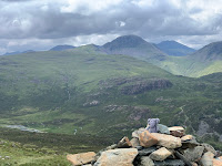
A short but satisfying circuit on a dry but cloudy day to see whether the view from Haystacks was the mystery view in Lakeland Walker. It wasn’t.
Route: leaving the car in the Gatescarth Farm carpark (£4 all day) below Fleetwith Pike and ascending the ridge slowly mainly on the edge until, near the top, where the route cuts a little in to the right, with increasing views back north to Scotland. From the summit descending south-east on an indistinct and occasionally marshy path to quarry works and then down to a stream, crossed on stepping stones, to find a paved route towards Haystacks. For once, spurning the right turn onto a higher path under Green Crag and, instead, keeping to the main route to Innominate Tarn. Then forking right to clamber to the summit area, settling on just the most south-easterly summit. Descending to Scarth Gap on the more stepped rocky path further north and east than the scree alternative and then back down on the stony but improving path to the lakeshore and across the head of the valley to the car.
Conditions: sun first thing had given way to cloud but no rain, humid.
Pub? The Buttermere pubs still being closed because of C-19, the Kirkstile Inn under social distancing for Cumbrian Legendary Ales Loweswater Gold.
7 July 2020
Sale Fell to Ladies Table
A 9km run.
Route: leaving the car near the Pheasant Inn, Bassenthwaite, and running up the road towards St Margaret’s Church, Wythop, for 1km to take a diagonal grassy path south west up and across the hillside to reach the west end of the ridge at a wall. Then turning east to walk up the ridge to the summit. Running downhill in line with the Dodd to a gap in the wall and up to a subsidiary summit and then down to a subtle saddle turning right to take a scratchy path through gorse doglegging right-left to follow a path to Sustrans Route 71. At the edge of the forest plantation (currently felled) taking a path just outside the fence and plantation to reach a level path to the right horse-shoeing round the ridge protruding south-west from Ladies Table. At a gate taking an initially subtle path slowly gaining height over the valley through the oak trees of Hagg Wood and targets for woodland archery dotted around. Where the obvious path turned right, following a theoretical path left and right across felled trees, a broken wall and over a barbed wire fence to scramble up the recently completely felled tump, Ladies Table. Then picking a way back to the Sustrans track descending towards the lake and taking the first left turn on a wide smooth forest track, down and then up and then down again, to the forestry offices and then along a path directly to the (residents only section of the) garden of the pub
Conditions: cloudy, cool for July but not actually cold, just missing the showers
Pub: the Pheasant Inn, Bassenthwaite, for a C-19 socially distanced (partitioned) pint of keg Sharp’s Atlantic Pale (because the real ales were still settling) and home made crisps.
6 July 2020
Grisedale Pike and Hopegill Head from Whinlatter Pass
An 11km walk on a dry but blustery day on the first full day at Lorton after the relaxation of the (first?) C-19 lockdown.
Route: leaving the car in the free parking area to the south of the Whinlatter Pass just above the two cottages. Walking along the route of the C2C on a forest track to a point where a wide path heads right with a post (N78) and leading uphill, eventually reaching the edge of forest and then along a clear, well-established path on an increasingly distinct ridge up to Hobcarton End. Then along the broad ridge to Grisedale Pike. Descending and re-ascending to reach Hopegill Head and down the slightly awkward rocky slab to reach Ladyside Pike. Down the broad grassy ridge and, this time, passing the first fence and keeping on on a path dropping slightly off the main ridge to the right. Level with the end of the forest below, heading right towards it but struggling to gain access. Naughtily climbing a wall to descend to a path back to a subtle stile into an overgrown region of the forest but finding a bridge over the stream to join unused but clear forestry trails as far as the previous route and then along forest tracks to the start.
Conditions: cloudy but with views, at least, of sun. Gusty.
Pub? Yes: Middle Ruddings for socially distanced pints of Barngates Tag Lag and Ulverston Lonesome Pine.
5 July 2020
Brackenthwaite Hows Tootle
An Outdoor Days entry because the first run based in Lorton after the relaxation of the (first?) Covid-19 lockdown.
Route: leaving the car in the Lanthwaite Wood National Trust car park and taking the steep shortcut to reach the start of the small path up Roger’s Steps to the summit plateau of Brackenthwaite Hows. Descending south and picking up the path within the wood by its eastern wall to join the small path descending to the boat house. Thence round a very full lake, having to pick a way on rocks to get to the two footbridges at the outflow and getting soaked by a stray wave approaching the water pumping station. Heading right along the stream/river to Park Bridge and along the very minor road passing Muncaster House to join the Loweswater road close to the car park.
Conditions: blustery and a timed gap in heavy rain made possible by modern radar technology.
Pub? (C-19) No but, earlier, pints of Fell at Tweedies Grasmere on the journey up the cottage. Afet the run, a can of Hawkshead Five Hop at the cottage for T.
Subscribe to:
Posts (Atom)