31 December 2018

Loughrigg from White Moss

A short afternoon walk on New Year’s Eve with Anne, Frank, Helen, Andrew, Anton, Lois, James and Lois.

Route: leaving the cars in the northern White Moss car park and crossing the road to walk through the woods to the new wooden footbridge at the western end of Rydal Water. Then crossing the bridge (gate recently vandalised with a chainsaw) to walk up to Loughrigg Terrace and turn right to take the steep, direct route up to the summit just before Red Bank. Heading east off the summit following intermittent, eventually waterlogged paths steeply down to regain Loughrigg Terrace and follow it left (west) until the fork down to the wall-gate back into the trees and down to the other footbridge and back to the car park.

Conditions: high cloud with spits of rain to begin with but wide views on the summit

Pub: the Badger Bar for Hawkshead Red, Corby Blonde and cups of tea and pop for the others!

28 December 2018

Crummock Water to Kirkstile Inn saunter

An epic 6km journey of discovery following the unexplored waterside trail upriver to Crummock Water.

Route: leaving the car at the Lanthwaite Wood National Trust car park and, for the first time, climbing a riverside fence out of the car park to follow a wooded path running beside the rushing river to the weir at the north end of Crummock. Then via the Pump House and Low Park on paths and the road beside Park Beck to the Kirkstile Inn for lunch with Mike and Janet Hornby. Back via Gillerthwaite, Muncaster House, the Pump House and the same outward riverside route.

Conditions: before lunch, low cloud shrouding the hills. After lunch, blue skies and late sun.

Pub: the Kirkstile Inn, Loweswater, for Cumbrian Legendary Ales American Pale and Esthwaite Bitter and lunch with Mike and Janet.

27 December 2018

Eagle and Sergeant’s Crags

A surprisingly arduous 12 km walk on an empty 27 December day in the North Lakes.

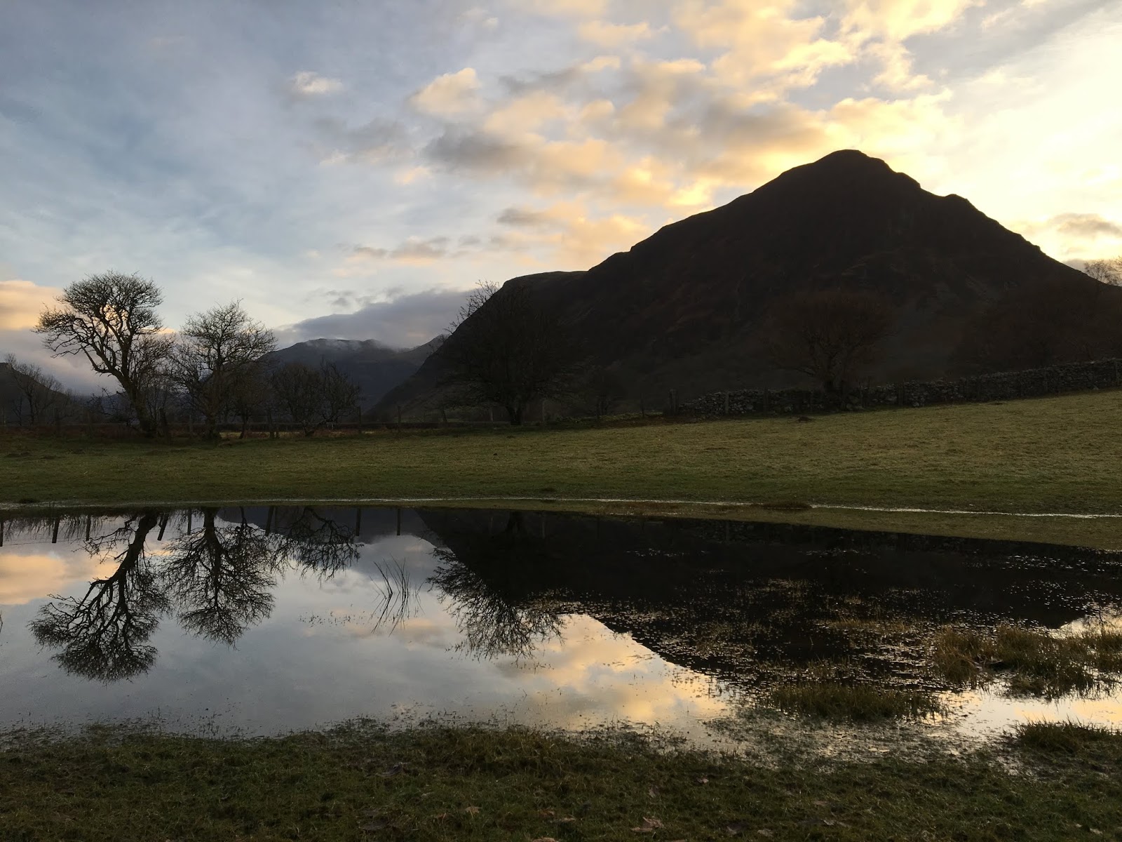
Route: leaving the car in a lay-by approaching Stonethwaite and crossing the river to walk south-east on a substantial stony track with growing views of Eagle Crag. Crossing back over the river and turning left on a subtle marshy track keeping parallel with the river but, after a gate, trending right and uphill (possibly too soon) to cross another wall and then follow a clear path to the ridge. Here crossing a stile whose foot plank was secure but hand rail swung alarmingly back over the steep hill behind. Following a clear path up and turning left to climb a wet but secure rock staircase with no sense of exposure to turn right on a white quartz track with a bit more sense of the space below. Then taking a zig-zagging marshy path between rocky bands with a couple of slightly nervy staircases crossing bands to reach the summit. Then along a broad marshy ridge to Sergeant’s Crag. On for another 500m and deciding to turn right (probably too soon in hindsight) to try to find a Mark Richards’ pathless descent to Tray Dubs. Then having to contour round the hillside so as to escape obvious crags and eventually roughing it down steep, slippery and occasionally rocky grass to the valley bottom with much cursing. Joining the Cumbria Way and following this back, stopping to look at Black Moss Pot, and, much further on, cross the river west to follow a clear but stony track back to Stonethwaite and the start.

Conditions: low cloud and muted colours and but no actual rain.

Pub: the Scafell Hotel, Rosthwaite, for Jennings Sneck Lifter.

26 December 2018

Ling Fell and Sale Fell

A 12km run with uphill walking interludes on Boxing Day, once Angie and Alistair had left.

Route: leaving the car at St Margaret's church near the Pheasant Inn and running along the road to Wythop Mill and on to the green lane Green Lonning, rising and circling underneath Ling Fell. After a short descent, taking a left turn on a footpath rising to join a track and following this to reach access land. Shortly after, taking a left turn on a faint path and making up an ascending zig-zag from available sheep tracks through gorse to reach grassy hillside and following this to the top of the ridge. Crossing a fence to find a clear path to the trig point. Turning left by 90 degrees to descend to find a clear track heading yet further left and following this to within 200m of the wall and bending right and then left downhill to join the Corpse Road and clear run down to Eskin. Descending to the informal parking area and then gently uphill on a road to Kelswick before turning almost 180 degrees to follow a clear path to gain the end of the ridge and then by a combination of running and walking, gaining the summit. Heading east to Lothwaite and then descending on a large clear grassy path between bracken to the church.

Conditions: cloudy and windy with a hint of rain but not cold.

Pub: the Pheasant Inn, Bassenthwaite, for Coniston Bluebird and Cumbrian Legendary Ales Loweswater Gold.

25 December 2018

Coledale Beck and Stonycroft Gill circuit

A 12km run with uphill walking interludes to work up an appetite for Christmas dinner.

Route: leaving the car on the road in front of Middle Ruddings and running through their garden to turn right on the minor road behind heading north to Spring Bank to find the valley path to the west of Braithwaite How as far as the Tibetan Bridge and then climbing the road to reach the start of the path heading south west above Coledale Beck. After 4-5km, crossing the beck on stepping stones and walking up hill first on the main track and then turning left on a clear grassy, possibly ex-tram, path zig-zagging to meet the track descending from Sail, past High Moss under Outerside and down the valley of Stonycross Gill on an improving and rather delightful running track eventually joining the road under Barrow. After 200m heading gently uphill on a lovely path above woods to Braithwaite Lodge and then directly back to the start.

Conditions: still and dry but in very low cloud, running up into mizzle and down again, meeting 3 people in two hours!

Pub: joined by Angie and Alistair (for Christmas evening), Middle Ruddings, Braithwaite, for Hawkshead Sundown and Fell Proper Crimbo.

24 December 2018

A circuit of upper Lorton Vale including Fellbarrow and Brackenthwaite Hows

A 21km walk starting late after some emergency Christmas grocery shopping.

Route: from the cottage to Low Lorton along the road, across the river and rising past Low Bank Farm and High Bank on a green road rising onto the shoulder of the hill ominously passing a farmer gathering holly (who might have barred our non-right-of-way). Taking a track south, at first muddy and then grassy to reach open access land. Then steeply uphill to reach Hatteringill Head and descending and ascending to reach Fellbarrow. Keeping to the (undulating) summit ridge to Low Fell and then descending into the comb to the south. Following a sheep track becoming a clear - perhaps ex-tram - track to reach a partially tarmac track down to the road and thence to the Kirkstile Inn. After a pint, along the road to Scales and turning right to reach Robin’s Steps and the top of Brackenthwaite Hows then experimentally descending a ridge north-east bearing left before the end to reach the footpath, cross the road gaining the under-fell path back to High Swinside Farm and then home.

Conditions: brilliant low but surprisingly warm sun but with frost under foot.

Pub: the Kirkstile Inn, Loweswater for Cumbrian Legendary Ales American Pale and Loweswater Gold.

22 December 2018

Circuit above Brigsteer

A 7km+ run onto the Scar from Brigsteer.

Route: leaving the car in a large layby (space for 10+ cars) north of the village and running back, south past Brigsteer on the lower road but branching left on a footpath signed St John’s Church just beyond the village. Uphill across a couple of fields to turn right on a track and then branching diagnonally left off it across the large field to Helsington Church. North to the entry to the Scar and this time along the most western path along the scar to the large cairn (Dave’s Cairn) and down to Barrowfield Farm. Right then left to take a footpath descending through trees and across pastures eventually to strike a very quiet minor road. Left along this to reach the main Brigsteer-Underbarrow road and back to the start.

Conditions: cloudy with dark clouds to the north. A rainbow.

Pub: The Rifleman’s, Greenside, for Greene King Abbot Ale (hurrah!).

16 December 2018

Staveley 8km run

An 8km run on a wintry day.

Route: leaving the Staveley Mill Yard via the foot bridge over the River Kent and taking the muddy path over south east field in the direction of the sewage works. Turning right along the road and then left 400 yards later on a steep drive before crossing a stream below a small waterfall at Side House and rising gently onto the edge of the fellside. Then turning left through Birk Field farm to join the minor road north and following this up the valley on road and track to Ghyll Bank, turning left descending over fields doglegging left-right across a road, to reach Elf Howe and then the bridleway and farm track to reach the road to the rear entrance to the Mill Yard.

Conditions: grey but high cloud.

Pub: the Hawkshead Brewery, Staveley joined by Andrew and Diane for lunch and for Hawkshead WPA and Jester.

9 December 2018

High Rigg

A 9km run on the best day of a three-day birthday weekend.

Route: leaving the car at Rough How Bridge despite its formal closure at one end, at least, because of the United Utilities pipework and ignoring footpath closed signs to follow the lower of the two (perfectly unblocked) north-east paths keeping underneath High Rigg, past Shaw Bank and along a metalled road. Taking a clear path rising off the road gently to cut the corner onto the track rising steeply to the church (walking) but taking a grassy track off and uphill to the right before it. Proceeding walking (the steep bits) and running to the summit of High Rigg and then along clear sometimes marshy paths all the way along to Wren Crag and then descending to the road. Crossing the A5091 to Bridge End Farm and following a footpath north, back over the river to Smaithwaite (and a disused pub) and then on a large forestry track under The Benn to Shoulthwaite Farm recrossing the A5091 and back to the start.

Conditions: wintry but dry with high clouds and some hints of sun. Muddy under foot.

Pub: Tweedies, Grasmere, for Thornbridge Galaxia, Turning Point Rising Tide and lunch.

8 December 2018

Brackenthwaite Hows

A short 7km late morning run anticipating a poor forecast for the rest of the day.

Route: leaving the car at the once phone box now defibrillator on the way to the Kirkstile Inn and running back to the Lanthwaite Wood NT car park where turning sharp left to climb to Robin’s Steps and hence along the subsidiary ridge to the summit of Brackenthwaite Hows. Descending south through woods and then curving left and then right eventually to the boathouse on the shore and then round the lake past the, today-submerged, swimming beach as far as the pumping house. Turning right and along the river to a slightly raised track and then by a walled stony riverside path to reach Lowpark and almost Park Bridge. Here, for the first time, heading south along a path through Flass Wood to reach the familiar under-Melbreak path and round it to descend to the Kirkstile for beer. Afterwards, walking back to the car in the now-steady rain.

Conditions: initially cloudy and breezy but rain slowly increasing.

Pub: the Kirkstile Inn, Loweswater for Cumbrian Legendary Ales American Pale Ale and Langdale.

7 December 2018

Latrigg

A quick, short 7km stroll post lunch on an iffy birthday day.

Route: leaving the car in the B&B quarter in Keswick and crossing the footbridge into Upper Fitz Park to take roadside footpaths to Briar Rigg and then turning right along a track to cross the A66 and ascend. Taking the first right turn along a track and at a four-way junction continuing on on the higher path under the fellside as far as a small cross roads where turning left on a steep zigzagging path up hill, eventually becoming a straight steep tramp uphill out of the trees and onto still steep grassy fellside. Crossing a barbed wire fence with care and then along to the ambiguous top of Latrigg. Then back north west on a very clear, well-maintained zigzagging path to join the Cumbria Way and thence back to Keswick.

Conditions: some initial rain giving way to cloud and high wind.

Pub: the Square Orange, Keswick for Corby Oktohop Black IPA.