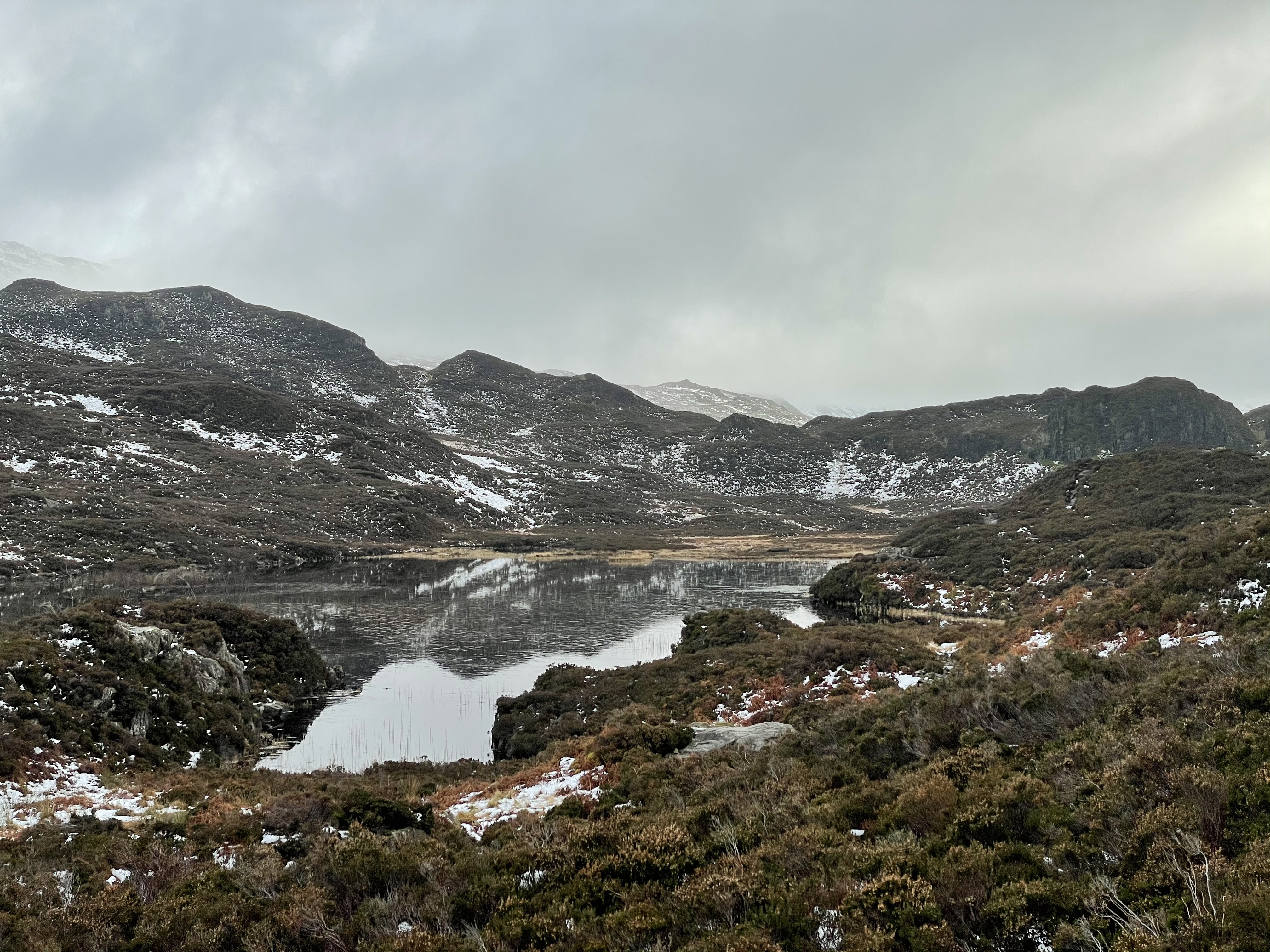
31 December 2020

To the cairn above Swinside on the ridge to Ladyside Pike

A 9km walk at the end of the afternoon of New Year's Eve, arriving home across muddy fields in the dark.

Route: leaving the cottage and walking to Boonbeck and up the road to take the track from Scales to High Swinside Farm. Turning diagonally uphill to cross the road and take an obvious track north east towards a wall. Here walking steeply uphill reaching a snowline. Once the hill eased walking between the wall and a fence, crossing the fence to climb onto an obvious subsidiary ridge and following this round to a tiny but marked cairn. Heading further along the ridge and descending to the east to find the main ridge path and following this back down to the road. Heading back down the road to cross the outward route to Hopebeck and taking the path across fields to Low Swinside and increasing darkness to Boonbeck and home. 

Conditions: cold and frosty with snow on the hills.

Pub? a bottle of Ginger Tom (for T) and then later vodka on a Zoom call with Paul and Katya.

29 December 2020

Arnside Knott

A 9km walk with Andrew and Helen.

Route: Leaving the car on the promenade at Arnside and setting off on the coastal paved path but diverting onto the beach to avoid ice and walking round to the cove at New Barns. Continuing first on a rocky path and then returning to the beach to the next cove beyond Blackstone Point. Here climbing onto a path along the very edge of the low cliffs to Far Arnside. Heading inland to Hollins Farm and then uphill onto the Knott. At a junction of paths turning left to cross through a wall and climb to a viewpoint. Then diverting right to the trig point before continuing down hill in the direction of the viaduct and, by minor roads, reaching the car.

Conditions: bright and cold (3C) with clear views.

Pub? Mulled wine on the Arnside pier.

25 December 2020

Ling Fell

A short 5km walk on Christmas Day afternoon.

Route: leaving the car in one of two lay-bys (total capacity ~5 cars) on the upper road 200m short of Brumston Bridge and entering the Ling Fell fellside at a gate. Heading uphill left to join a level track heading clockwise round the fell. After about one quarter circuit, heading sharply back right on a clear path very slowly climbing the fell. At about where the map shows it ending, turning left at a clear path crossroads and then following an obvious route (crossing other paths) to the summit. For once, not descending to the Corpse (?Copse) Road but heading south west along the vague summit ridge to a wall/fence and following this increasingly steeply down hill to Bladder Keld above Tom Rudd Beck and following the clear track to join Green Lonning (keeping to the track to the end, rather than keeping to the right of way to reach the start of the greenway, and hence having to climb a gate out of a field). Back along this to join the road and then uphill to the start..

Conditions: a cloudy day with an initial hint of drizzle. Despite the ground being frozen (minus 4C the night before), not cold.

Pub? Later, the full panoply of Christmas meal drinks starting with a Red Christmas (Campari, vodka and orange juice with some additional fizz).

24 December 2020

Sourfoot and Darling Fells

A last-minute 7km walk on a very short winter day.

Route: leaving the car on the larger layby by the telephone box beside Loweswater and talking the track uphill to Miresyke and then up to the old fell road. Turning left gaining height to the moorland plateau. At a wide, fenced, straight track, turning right towards Sourfoot Fell, the terrain very wet but easier because frozen. At the end of the fenced section continuing briefly on a track in the grass to its end and then heading in the direction of the summit using sheep tracks, steeply at the end. Descending to find a path to the right/west to the next piece of high ground and then heading in the direction of the summit, crossing a fence and then following parallel to another fence, and then crossing a final one before the fell summit. Here turning left to descend steeply into the comb and take the familiar path back but, for once, taking the upper path at a fork, exploring a tiny subsidiary summit and then descending to the normal tram track to the fell road. Turning right up this and then left on the outward path.

Conditions: bright and cold (1C) with clear views. Soggy under foot where not frozen.

Pub? Much later, bottled Ilkley Bewery Mary Christmas and Titanic Plum Porter.

20 December 2020

Brackenthwaite Hows variant

A tiny 5km run to blow away the cobwebs on a wet and windy weekend..

Route: leaving the car at a surprisingly busy Lanthwaite Green NT car park and heading towards the lake but, on the spur of the moment, heading slowly uphill on a broad track to reach the usual junction at the bottom of the wall down from Brackenthwaite Hows and continuing in the usual way, parallel with a wall marking out the boundary, south, joining a bigger track and then diverting off it to drop down to the boathouse and then back to look at the flooded outflow. Retracing the route and then climbing through woods to reach a second slightly lower slowly ascending path to near the south end again and running back, parallel with the boundary wall, up onto the summit and down Robin's Steps to the start.

Condition: initially heavy rain, thereafter mainly holding off.

Pub? bottled Fyne Ales Jarl and a can of 4.7% Aegir Sumbel Porter at the cottage.

7 December 2020

Outerside 11km run

A birthday run on the third, but final, dry day in a row.

Route: leaving the car at the eastern foot of Whinlatter and crossing the Buddhist bridge, passing the Coledale Inn and heading uphill on the road towards Stile End. Beyond the road and initial stony track, on open fellside, bearing a slight right uphill (at a walk) to a clear crossroads of paths. Turning right and following a more or less level but narrow and laterally sloping path along the side of the valley around the 300m contour. Despite the indication on the map that it gives up and descends, finding a clear enough path continuing to rise all the way under a sheep fold and then descending and crossing Birkthwaite Beck to meet the path climbing from the valley floor. Following this, at a walk, as it zigzagged steeply and snowily uphill to the pass but bearing left at a fork to climb Outerside. Descending carefully to the saddle before Stile End and heading right on varying paths to reach the main bridleway below Barrow to Stair and then keeping off the road a little longer on a grassy path. Finally climbing west of a wood to descend to Braithwaite Lodge and back by roads to the car.

Conditions: cloudy and chill on the top. Some frozen snow under foot at altitude but sadly the marshy terrain as yet unfrozen.

Pub: the Coledale Inn for a pint of Tractor Shed Mowdy Pale Ale and Alpaca Blonde and surprisingly large ‘light bites’ (to meet the Tier 2 requirement of a ‘substantial meal’ with any alcohol, although the lady behind the bar told us to 'eat as much as we liked' when we arrived).

6 December 2020

Grange Fell, Great Crag and Castle Crag

A 16km walk with Ian Wilson on a day of shifting clouds and mist but also unforecast moments of sunshine and patches of blue sky.

Route: leaving the car at the Bowderstone car park (capacity 60 and empty at 9:30am) and heading along a path north above the road but below cliffs to the right to join a path coming up from the road and trend right/east descending into woods and a wall. Here turning right and ascending a path that soon became steep and stepped, slippy in the damp. Arriving at Long Moss, following a clear path right working its way round and then onto King’s How. Descending to the south and backtracking along Long Moss to cross a stile but ignoring the obvious route turning left to follow a wall onto the summit plateau and then across two walls to reach the summit of Brund Fell. Descending a clear muddy path to Puddingstone Bank and then following a marshy path - including the diversion round delicate peat bog - to climb beside Great Crag but turning right on a faint path to reach the summit. Descending south and here failing to take the less attractive (but correct with hindsight) left turn and hence getting a bit lost. On reaching the small unnamed tarn heading confidently to Dock Tarn on very marshy paths and then down the stepped and tricky but not slippy path to Stonethwaite. Along the Cumbria Way to Rosthwaite and by the river to Castle Crag. Descending from the summit again to join the path on the west to Grange and back along the road to the car.

Conditions: very marshy, muddy and occasionally snowy under foot but litttle ice. Clouds bubbling up and then dispersing below us in the valley.

Pub? C19, Tier 2, so two of us shared a large bottle of Fell Tinderbox IPA back at the cottage (and Ian drove back to Kendal

5 December 2020

Bleaberry Fell, Low Rigg and the Keswick Railway Path

A nearly 20km walk/run in snow on the first day that the Keswick Railway Path officially opened.

Route: leaving the car in the B&B quarter of Keswick and running along Grizedale Close to Springs Road and along this bending left onto a stony track gaining height parallel to a stream, crossing it left to gain the road and then back at Rakefoot, climbing onto open fellside before taking a gate to the wooded path to Walla Crag. Then across boggy ground, partially improved by a Fix the Fells alluvial subsoil path and then on frozen snow steeply up to the summit of Bleaberry Fell. Continuing first south and then east in deep snow (occasionally sinking to our thighs) and descending just to the left of a stream. Then bending a little north to descend a grassy though stony shelf, finally descending very steeply and wetly to reach a T-junction of walls (where the promised sheepfold did not seem to be, this having always been the grey area of the route. Passing through a hand gate ('No access to Helvellyn') to continue on a welcoming path (finally!), unfortunately uphill of the wall below which the Wainwright route goes (to which no access seemed possible). A bit further on, tracking down the slope to follow the wall and then finding a section already-collapsed and so, without much guilt, popping through and making rather a clumsy business of passing Snipeshow Tarn and even descending Snipes How. Finally gaining the bridleway at ground level and thus the A591, having picked our way to this point painstakingly almost all the way down from the summit. (But made WELL worth it by the sighting of a small posse of magnificent deer at various points, making quick work of the same terrain - and bounding over high walls - whenever we disturbed them.)

Turning right on the road to Dale Bottom, then left on a path through a small caravan site, across a path crossroads, then next right to cross fields to climb to the saddle between High and Low Rigg. Visiting St John's-in-the-Vale church and then turning left opposite to traverse Low Rigg and descend to Tewet Tarn whose perfect reflection of the snow on the hills across had caused an optical confusion. Right along the B road to find a path in woods to the Keswick Railway Path and joining crowds of walkers, runners, skateboarders and cyclists along this back to Keswick, leaving before the end to return to the car.

Conditions: a cold but brilliantly sunny day. Much of the day with extremely wet feet.

Pub? Back to the cottage for tea and shop-bought cheese scones and later the residue of the previous night’s Zoom CAMRA Roger Protz beer tasting beers (Shepherd Neame IPA, Adnams Tally-Ho, Traquair House Ale, Robinsons Old Tom) while talking to Paul and Katya.