27 April 2024

15km Kentmere valley run

A 15km Saturday morning run the length of the Kentmere valley.

Route: leaving the car on Windermere Road, because of the new parking charges at the Mill Yard, and running back to the village centre and left along Silver Street and Kentmere Road past Barley Bridge and on the ‘main’ road past the next bridge and continuing to Browfoot. Continuing along the track to Ullthwaite Bridge, past the pottery and the Hollingworth & Vose factory and on the newish path diversion along the valley, spurning the left turn at a romboid crossroads to continue to Kentmere village, past the church and back along the main road. At Long Houses, taking an unmarked track slowly and then suddenly gaining height (slowing to a walk for 300m) and then continuing along more level moorland tracks to reach a familiar summit, turning left to join a track that becomes the top of Hall Lane and down this to Barley Bridge and the rear entrance to the mill yard.

Conditions: initially 7C and cool in the shade but warm in the bright sun.

Pub: the Hawkshead Brewery, Staveley, for WPA.

20 April 2024

Lorton to the Coledale - high road (T) and low road (L)

A 9.5km run, for Lois, on road and then largely on forestry tracks. A 14km walk, for Tim, over Whiteside, Hopegill Head and Crag Fell.

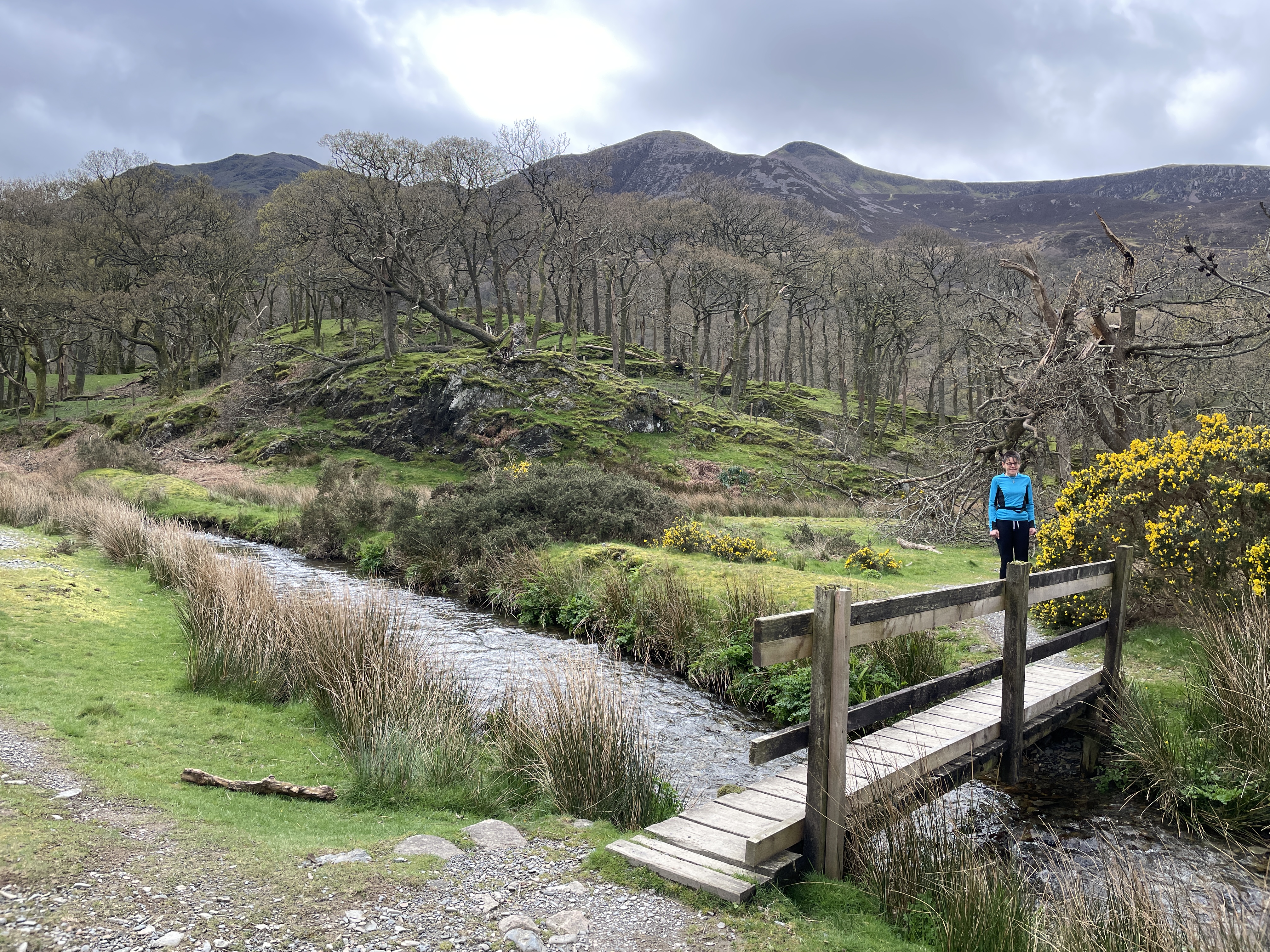
Route (Lois): Leaving the cottage and turning left to turn up Tenter Lane and run up to join Whinlatter Pass. There turning right and following the road up as far as the car park just past Swinside Houses where the off-road C2C route turns off. Following that forestry track east as far as the Revelin Moss parking area and then bearing right/east to continue running south of/parallel to the pass road, zig-zagging a couple of times to continue going roughly east and cross Masmill Beck, eventually bearing right onto a smaller, shady track to contour round Heavy Sides and head south to escape the trees and soon cross a stile onto Kinn. 

Then running across a field to turn left on the path coming down from Grisedale Pike. (Turning back from and abortin an attempt to take a path heading straight across and steeply down the fellside when it became to slippery, steep and unreliable.) Running down the Grisedale Pike path to the car park and crossing it to join the track towards Force Crag Mine. After about 100 yards, ducking under a fence to follow a clear path down the fellside (on the map!) towards the river. Detouring left on the next path to join the road for a few yards and then turn right on the path along the river to the footbridge with the prayer flags, and then take the back lane up and round some house to arrive at the Coledale Inn (and eventually find T, hidden inside).

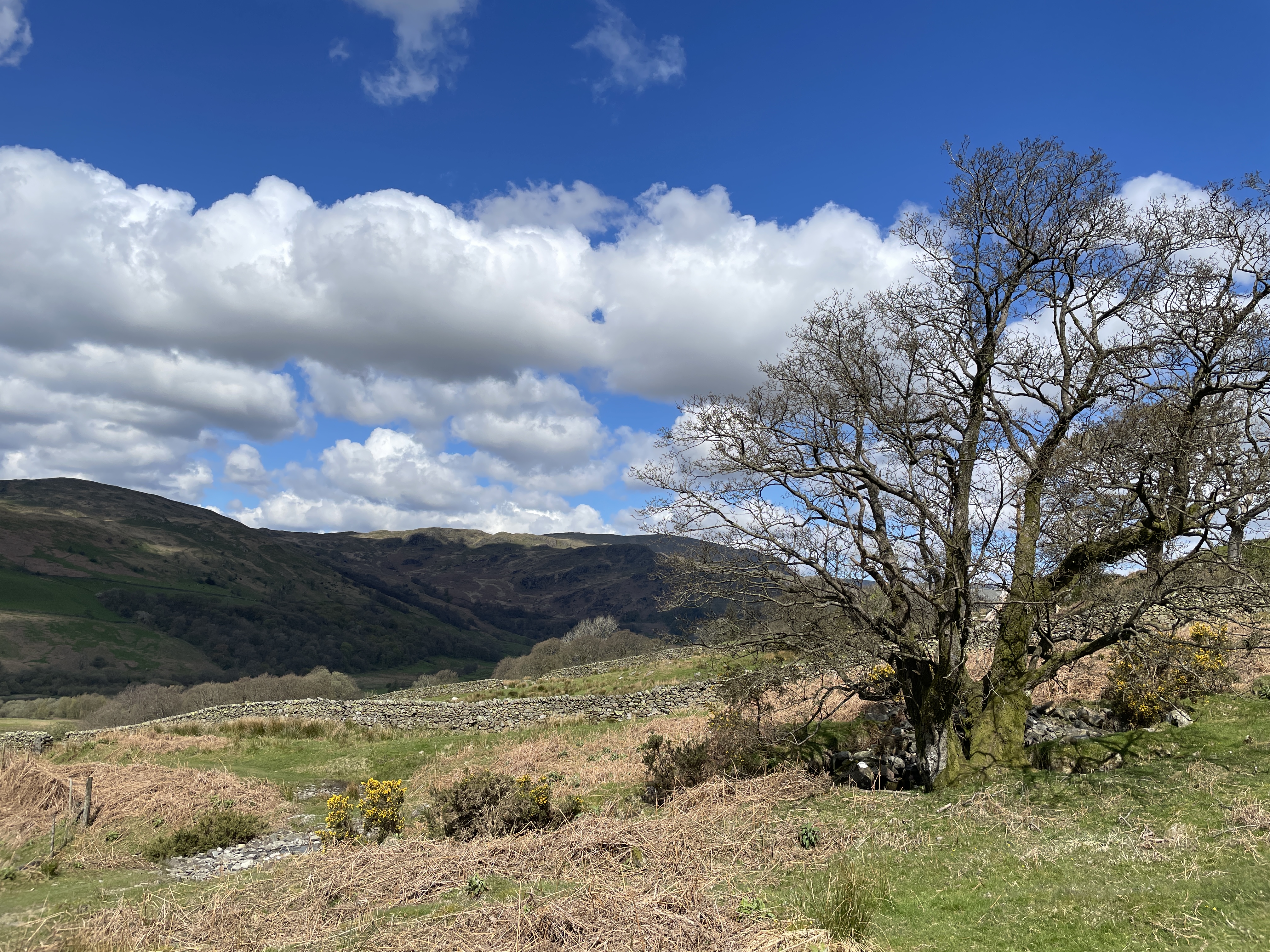
Route (Tim): Leaving the cottage and walking up the Boonbeck Road to Scales and then along the green track to High Swinside and along the road and then footpath to the new footbridge over Hope Beck. Continuing along the lower path over one obvious and one less obvious stream but trending uphill (otherwise too soon) to minimise marshy ground find a faint path to join the clear main path just above a large white stone. Continuing uphill, just remembering to take a half right uphill to reach a ruin and thence the saddle behind the Dodd. Then slowly up the clear path to Whiteside and left to a busier Hopegill Head.

Descending over Sand Hill to Coledale Hause and taking, for the first time in many years, the scramble up a gully on Eel Crag and to a very busy Crag Hill (taking turns to take pictures on the trig point). Descending and reascending to Sale. Then trying to find a different path off marked on the OS map but finding no plausible route on the ground and returning to the zigzags. Descending left on the main track over High Moss, diverting slightly left early to a less stony path eventually to reach Barrow Door and down to Braithwaite.

Conditions: initially high cloud with some thin sun. Later, straightforwardly sunny and warm.

Pub: the Coledale Inn for Corby Blonde. Afterwards, there being no sign of the 3:30pm 77 bus home, waiting another hour for the 4:30pm bus, itself then 20 minutes late.


19 April 2024

Slightly extended 9km circuit of Buttermere

A 9km run in the middle of a busy day of meetings for Lois.

Route: leaving the car in the NT car park (fairly full nearing noon) and taking the path north-west through a gate to turn left onto a clear gravel path. Turning right off this on a fainter path to ascend slightly and then descend to the north of Long How and to the Crummock Water lakeshore. Turning left to cross a footbridge and circuit Nether How and back past the campsite to the central village car park. Climbing up the road to pass through Wilkinsyke Farm and thus circuit the lake clockwise taking the path over the tunnel. On reaching the south end of the lake 6km later, continuing along the wet and trippy riverside (Buttermere Dubs) path to the second bridge and back to the pub from there. 

Conditions: mainly cloudy with some hints of sun. 

Pub: the Buttermere Court Hotel for Corby Blonde. 

17 April 2024

Along the banks of the Kent from Staveley

A 9km solitary run down an back up the banks of the Kent.

Route: Taking the 10:21am train to Staveley and running from the station along the Banks to the main road to join the Dales Way. Following this past Haggs Bridge and the Cowan Head complex to run along a bit of road in Bowston and cross the river and then take the riverside path back north to Haggs Bridge. Taking the path through the woods to the end and then backtracking to the start of the track to Side House but taking the track in woods (Spring Hag) to the left. This petering out - it is neither legal, nor a route and worth forgetting - so roughing it uphill to the road and turning left to reach a path descending through the (Dorothy Farrer's) woods to the road. Then taking the road to the path back to the footbridge and the Mill Yard.

Conditions: cool (7C) but sunny.

Pub: (Hawkshead Brewery having just moved its opening time later to 1pm) Eagle and Child for Bowness Bay Swan Blonde.

5 April 2024

Reston Scar

A tiny wet post-lunch 3km stroll with Simon, Lesley staying dry in the village.

Route: leaving the car on Windermere Road, because of the new parking charges at the Mill Yard, and walking back to the village centre and left along Silver Street and Kentmere Road almost to Barley Bridge. Turning left uphill on track becoming a muddy path. At a path crossroads, turning right uphill on zigzags. Once onto rougher very wet ground, keeping slightly right on a faint grassy track before heading directly to the summit, in sudden wind and rain. Descending closer to the line of the fence to the south, crossing a stile to reach a view over Staveley and thus down a steep single track path to rejoin the outward track. This time, at the crossroads, continuing straight across to School Lane and back to the car.

Conditions: initially cloudy. Heavy rain and strong wind on the top.

Pub: beforehand, the Hawkshead Brewery, Staveley for Downtime IPA, WPA and Clocker Stout and a crude lunch.

#

1 April 2024

Fellbarrow, Low Fell and back along the valley

A 20km walk with Kathryn, Steve, Tom and Alex Woodcock.

Route: from the cottage to Low Lorton via fields, across the river and rising past Low Bank Farm and High Bank on a green road rising onto the shoulder of the hill. Taking a track south at first muddy and then grassy to reach open access land. Then steeply uphill to reach Hatteringill Head. T at this point returning on the outward path suffering fatigue. Everyone else descending and ascending to reach Fellbarrow. Following the summit on the far side of the fence steeply down (the boys running) to a marshy saddle and then bearing up left across the fellside towards the top of the zig-zag path down to Thackthwaite (suddenly busy with people coming up). 

Walking briskly down this (the boys running) to the C-road and deciding to turn right towards Loweswater. Following the road to the end, past Foul Syke, and turning left on the main road and then right past the village hall to walk down to the Kirkstile Inn. Perching by the door to fortify ourselves with nuts and crisps and then carrying on. 

Taking the road from the pub to the old phone box and then joining the main road, past Lanthwaite Wood and over Scale Hill to the footpath through the wood under Tindle Crag, turning left through the gate in the wall at the far side to follow round the right side of the wall across very marshy ground and on past Picket Howe and across the field to cross the C-road to Buttermere. 

Taking up the path on the other side - initially clinging to a new fence, and walking along a tumbledown wall to avoid the mud but then just striking up the field to the gate in the intake wall and up to join the Lorton-Buttermere bridleway and follow it north 2km, through occasional gates, favouring the higher options, to the footbridge at Hope Gill, and on to the road and High Swinside. 

Walking down through High Swinside farm to the muddy fenced track running due north to Scales, where turning left down beside the farm and right onto the road, and left down to Boon Beck, over the bridge and along the road home!

Conditions: a blustery day with some very light rain in the wind, with heavier showers coming and going later in the walk - muddy underfoot but not as waterlogged as it had been

Pub: the Kirkstile Inn for Loweswater Gold, cider and various soft drinks (halfway round)