27 September 2020

Running circuit of Thirlmere plus Great How

A 19km run round Thirlmere finished with a weary plod up Great How.

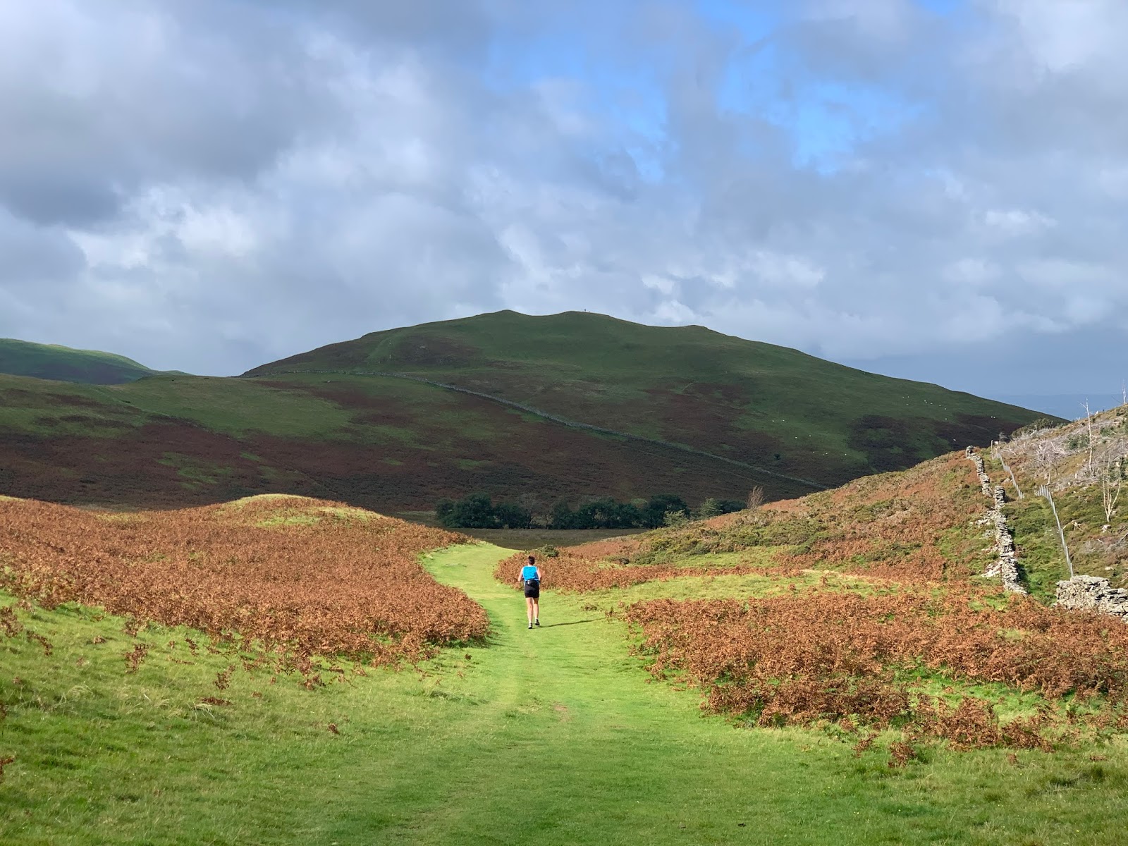
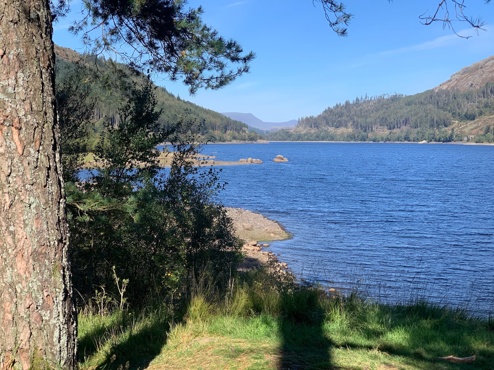
Route: the road across the dam being closed, parking on the A591 near Bridge End farm and running along the road across the dam to find steps leading down to a footpath along the western side of Thirlmere, sometimes a wide gravel path, sometimes trippy by rock or root and slowing the pace to a walk. At Hause Point and at Dobgill Bridge, rejoining the road for 50m or so. At Stockhow Bridge, joining the road round the bottom of the lake to cross the A591 and here finding a signed narrow path (not marked on the map) north to Wythburn church. At the car park heading uphill at a walk and turning left along the wide stony forestry track. South of the straining well, being forced to continue on the initially lower main track rather than join a more level contouring path closed because washed away, presumably, by the 2015 floods. After climbing again, descending to Swirls car park, crossing the road and descending close to the shore (though the lake mainly hidden by trees) and following a clear path, then joining a narrow permissive path through woodlands before rejoining the track and gaining a bit of altitude and arriving at a junction for Great How. Here walking up a stony track then narrow path to the summit, surrounded by trees impeding the view to the lake (but not to the Near Eastern Fells, see picture. Retracing the route to the last junction and continuing along the track east of Great How, taking a permissive path towards the dam road and then back to the car.

Conditions: blue skies and blazing sunshine though the air was cool in the shade

Pub: the King's Head, Thirlspot for Charles Wells Bombardier

26 September 2020

Loweswater fells circuit

A fine 15km autumnal round with Ian Wilson.

Route: leaving the cars at Maggie’s Bridge car park at 9am (almost full) and, in a last-minute change of plan, heading west towards the lake and the diagonal upward path through the trees to reach the coffin path. West along this to an exit gate and heading half left, uphill, to pick up a path heading left again, thus south, and uphill to the top of Burnbank Fell. Then along the ridge, much less marshy than sometimes, after a dry September, climbing to Blake Fell. Descending parallel to a fence and possibly missing a chance to cross it and thus wandering a bit further along a lower saddle ridge to find a bit of fence that could be bestridden. Heading back to the main path confluence at Fothergill Head and climbing, parallel to a fence, to the top of Gavel Fell and pausing here. Then down the ridge and up before crossing a stile and cutting a corner to find a path by another fence heading towards Floutern Cop. Having traversed that little tor, continuing on to climb Hen Comb on a clear path and descending the ridge, for the first time, all the way to a final wall, bending right steeply downhill and crossing the beck on stepping stones. To the Kirkstile Inn for a pint in the garden under 3-day old national table service-only restrictions and then back, by road, to the cars.

Conditions: a mere 2C at the start but warmer later, especially in sunny still spells, but cold in the wind. 

Pub: the Kirkstile Inn, Loweswater, for Cumbrian Legendary Ales Loweswater Gold.

23 September 2020

Cycle circuit of Fellbarrow via Rowrah and Dean

A 25 mile trip calling in at the Ennerdale Brewery and the Royal Yew at Dean.

Route: from the cottage taking the Thackthwaite road to Loweswater and slowly ascending Fangs Brow to Lamplugh. Continuing on Sustrans 71 past Keltonfell Top and Kirkland and stopping for a beer at Rowrah. Then on C-roads via Asby, Dean Cross and Ullock to the Royal Yew, Dean, for lunch. Home via Pardshaw and Brandlingill.

Conditions: cloudy with hints of drizzle.

Pubs: The Ennerdale Brewery, Rowrah, for Ennerdale IPA and Blonde. The Royal Yew at Dean for their own (ie Tirril's) Blonde and lunch.

22 September 2020

Circuit of Latrigg

An 8km run around and up Latrigg.

Route: leaving the car in the car park between Latrigg and Skiddaw (some spaces at noon on a busy week but a miserable Monday) and running down the Cumbria Way on a substantial path. After crossing the second stream, looking for a left turn onto a level path through trees. At a complicated junction looking for a path marked on the OS map which didn’t exist and thus turning left uphill along the edge of the woods and thereafter aiming not to lose height at various unmarked junctions, eventually reaching an area of cleared forestry and rougher uphill paths before returning to a level grassy path to the end of the ridge. There turning sharp left, running across wet grass and waiting for the main track to join us. Near the summit, leaving the track to climb a grassy slope to reach the path round the edge of the Loughrigg plateau to the summit. Then continuing round on the clear (wheelchair-accessible) gravel path eventually forking right, slightly uphill again and along to descend to the car park.

Conditions: low cloud and drizzle/light rain blown forcefully by the wind.

Pub: Having failed to find anywhere to park near the Keswick Brewery tap, Middle Ruddings, Braithwaite, for Tractor Brewery Mowdy Pale Ale.

21 September 2020

Balcony path under Carling Knott and Burnbank Fell

A short 7km walk with Robin and Virginia on a glorious autumn day.

Route: leaving the car at 9:30am in an already fairly full Maggie’s Bridge car park and heading along the lakeshore past Hudson Place and Jenkinson Place, slowly ascending a track onto the shoulder of the hillside. Taking a sharp left rising in the direction of Burnbank Fell and then left to pick up the obvious coffin route. After crossing Holme Beck, taking the path on the left into the wood and descending on a diagonal to the corner of Loweswater and back on the outward route.

Conditions: a warm, sunny (hot at times) and largely still day.

Pub: the Kirkstile Inn for Cumbrian Legendry Ales Session IPA and Loweswater Gold and lunch.

13 September 2020

Sale Fell with old Wythop church

A fine 8km run after a last-minute change of plan on a blustery day.

Route: leaving the car on the road near St Margaret’s Church, Wythop, and running along the road for a couple of kilometers to turn left at Wythop Mill to Brunston Bridge and then as far as Kelswick. here continuing to see the remains of the old Wythop church before returning to Kelswick to follow a clear balcony path north, this time cutting right on a smaller path before reaching the ridge end wall to zig zag up to gain the summit via subsidiary western tops. Heading east to Lothwaite and then descending on a large clear grassy path between bracken to close to the church between Routenbeck and Wythop Mill and then almost entirely down hill to the start.

Conditions: cloudy and windy with hints of sun. Afterwards, sitting in the pub garden, warm sunshine.

Pub: the Pheasant Inn, Bassenthwaite, for Hawkshead Bitter and brief sighting of a brown squirrel on the feeding box in the garden

12 September 2020

Brackenthwaite Hows 7km run

A 7km run late in an autumnal day having earlier cycled to Cockermouth to run errands and enjoy a pint of Jarl. The first repeat of this familiar route in a long time.

Route: leaving the car at the Lanthwaite Wood National Trust car park and taking a steep shortcut to reach the start of the the small path up Roger’s Steps to the summit plateau of Brackenthwaite Hows. Descending south and picking up the path within the wood by its eastern wall to join the small path descending to the boat house. Thence round the lake to Highpark Farm and round the end of Mellbreak before descending to the Kirkstile Inn and then back along the road to the car park.

Conditions: cloudy, grey and blustery with increasing hints of rain.

Pub? Spurning the option of sitting outside the Kirkstile and returning to the cottage to split a 440ml can of 3.8% Track Brewing Pale Ale.

6 September 2020

St Catherine's Tower and Lord's Lot from Crosthwaite

An 8km run in a variety of weather conditions.

Route: leaving the car by the road just over a bridge over the River Gilpin, north of Crosthwaite village at GR435919 and heading north on a grassy path by the river, through the grounds of Starnthwaite Ghyll and along the road for 1km to the first footpath to the right. Heading slowly uphill, walking where steep, to join a walled track to the left and then right to stay with the track now fenced. At Birk Moss, joining a paved driveway to join a grassy path across fields and continue to St Catherine’s Tower. Then following the path - and ignoring illegal no entry signs - through the farmyard at Crook Hall to descend due south across fields then rising to Low Fold, turning left and then right to a grassy path below Lord’s Lot. After crossing a stile, heading uphill by the fence to a first subsidiary summit and finding a clear path through the bracken over another summit and then down and more steeply up to the summit proper with a cairn, just as the rain began. Finding no clear path onwards, making slow going through bracken and across a marsh to regain the main path, initially rough and stony and then grassy, though wet under foot, to descend south west, through a gate and then by a wall to find a track to join a road and turn right at a fork back to the car.

Conditions: some initial sun giving way to light rain which largely passed over to leave cloudy sun. Just after finishing, on the drive to Staveley, prolonged torrential rain. Wet under foot on the return leg.

Pub: The Hawkshead Beer Hall, Staveley, for Hawkshead WPA and [Session Series 20] 05: Sabro vs. Ekuanot Pale (accompanied by sandwiches from More?)

5 September 2020

Hampsfell from Cartmell

A 9km run on a blustery day (surprisingly hot and sunny for the first few km).

Route: leaving the car at the Cartmel racecourse car park (£3.50 for 3 hours to allow for beer time) and heading north along the road parallel to the track, taking the right fork and then, a little later, forking right again onto a footpath at the edge of a field. Turning right into the woods and running east on a muddy track and a footpath across fields, and lots of tiny flag beck crossings, at one point watch a hare bound the length of a field in front of us, to cross a C-road and, after another field, doglegging across the B-road.  Running up a track to turn left at Hampsfield Hall and right again, leaving the track to join a path uphill across a field. Ignoring a sharper right turn to continue past a substantial lime kiln and descend slightly to High Hampsfield Farm. Here, choosing to go left and down the road and then right on a track (rather than right and left) to enter limestone country and continue parallel to Merelwood (confusingly labelled Eggerslack Wood on the ground). At a junction turning right on an initially switch-backing track to gain height and pass through a wall to the Hospice at the summit. Then  heading south on a grassy path and then west descending to Pit Farm and across a couple of fields and a road to re-enter Cartmel.

Conditions: some sun but mainly cloudy and blustery on the top.

Pub: the Unsworth Yard Brewery for Crusader Gold.